Here at Rubicon Archaeology Limited, some of our consultancy services we offer are desk-based assessments. Part of these assessments involve examining the cartographic record, including the 19th century Ordnance Survey.
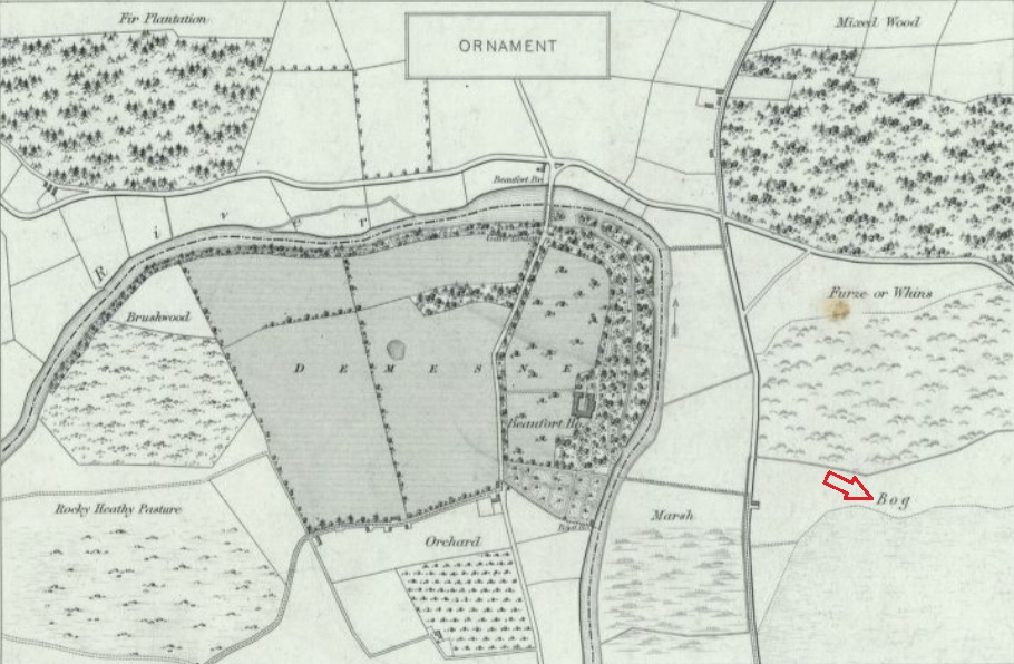
An especially useful resource for examining and understanding these maps are the Ordnance Survey Characteristics sheet, which contain the types, symbols and characteristics for various Ordnance Survey map series. One of the ways the characteristic sheet can be used is to identify the type and character of the landscape.
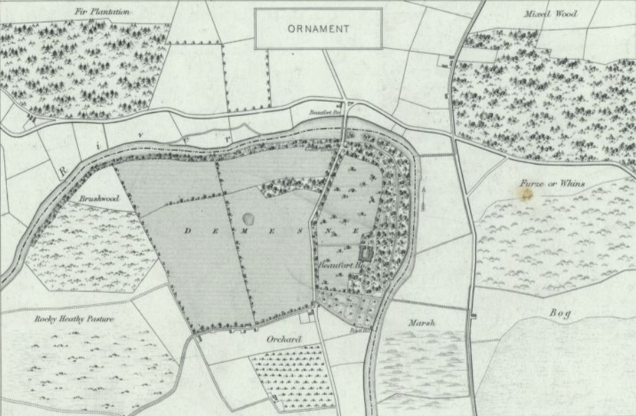
Image 1 is from the characteristic sheet for the 6-inch OS maps, and it shows the ornamentation used to highlight the different landscape types, such as demesnes, marshes etc. On the image, there is a red arrow pointing towards bog, which is depicted as a shaded area with horizontal dotted lines.
Using the characteristic sheet, we can examine one of Ordnance Survey sheets, CK072, from County Cork to determine the land type. Looking at the sheet, we can see that there is a large area of bog to the north and to the south (red arrows). You can also see that there is a demesne landscape (blue arrow) associated with Rock Lodge between the two areas of bog.
.jpg)
_edited.jpg)